How do the Inward Bound maps work?
Fri 20:23. 1x 📷. Posted by Chloe Woodburn - IB Marketing Officer.
Each year, the Course Setters (in 2024, Ben Grace and Jackson Jolly) create course maps that specifically define and describe the race area.
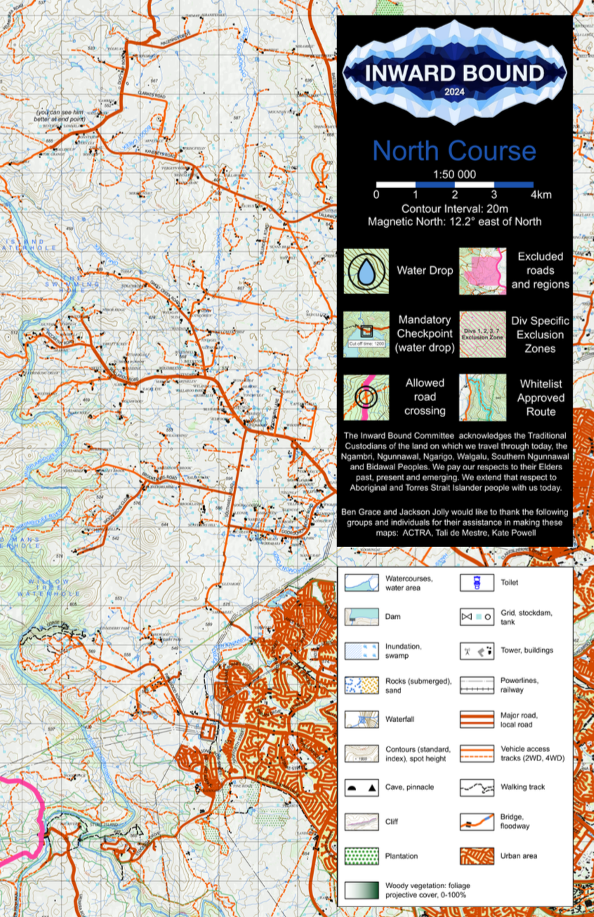
This year, every team will receive two A0 (aka really big) maps - a course north and a course south. Endpoint is smack bang in the middle of these two maps, which cover an area of almost 5,000 square kilometres (aka a lot of land).
The maps have all the course-specific information runners might need, including:
where they are permitted to cross busy roads
where they must wear their high-visibility vests
the location of whitelisted zones (areas that runners are explicitly allowed to traverse, usually highlighted because they are private property that we have permission to access, or to reduce ambiguities)
the location of general exclusion zones (out of bound areas - a team is disqualified if they enter an exclusion zone) and division-specific exclusion zones. On the IB Live map, exclusion zones are marked as red lines and shaded areas.
the location of water drops and mandatory checkpoints
Plus all the features you’d normally expect to see on a map (eg. roads, contour lines, water courses, lakes, powerlines, etc.) of course!
These maps are crucial for participants of Inward Bound, who will spend plenty of time in the lead-up to the event learning how to read them. Participants can’t use GPS to find their way around on course (without disqualification)! Every navigational decision they make is based purely on their maps, compasses, and observations about the land around them.
If you want to check out what the map looks like, I’ve attached a preview to this post!
